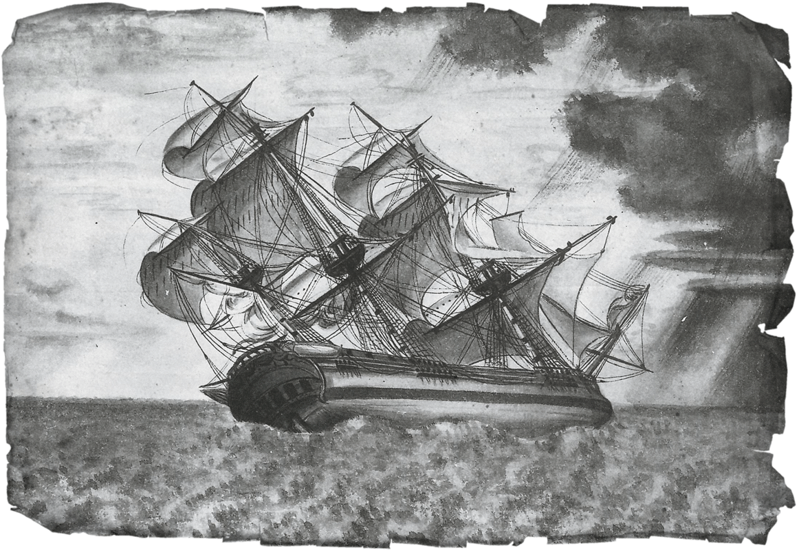
Within the Spanish crews it was common to have illustrators who captured the first images of the region they explored.
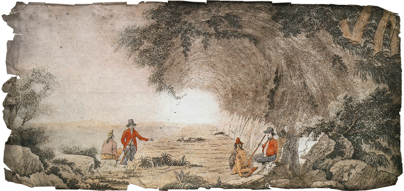
The region’s lush vegetation surprised explorers.
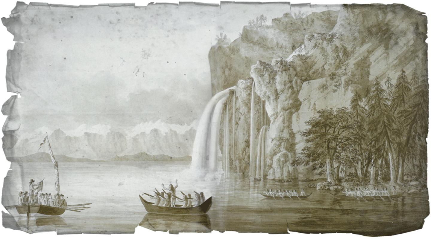
Even today, the Malaspina Gallery is a tourist attraction. This illustration is part of trips made in the mid-19th century.
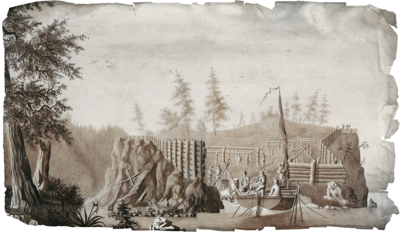
The Fort of Santa Cruz de Nootka is the only official construction of the Spanish Crown in the region. It remained in place for less than a decade.

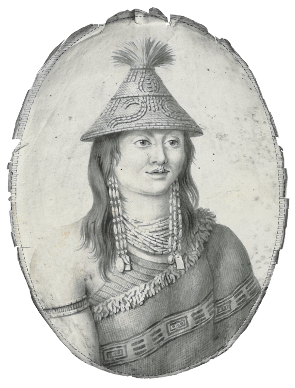
On many occasions, the navigation journals contained illustrations of the places and their inhabitants.
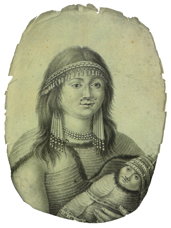
Upon the arrival of the Spaniards, the Nuu-chah-nulth were an established fishing community on the island of Nootka.
Chief Maquinna was the leader and spokesman of the community. He had to establish contact with European explorers.
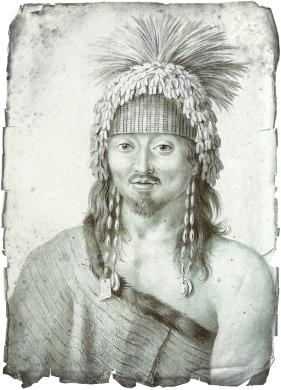
The legacy of Maquinna continues today, after several generations of Maquinna Chiefs.
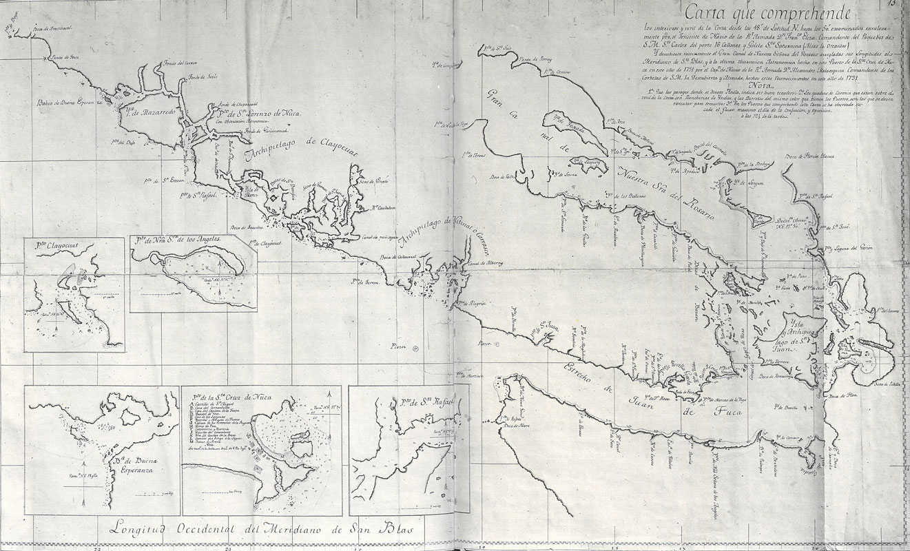
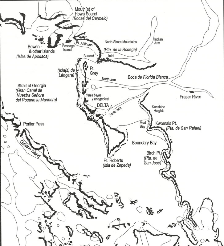
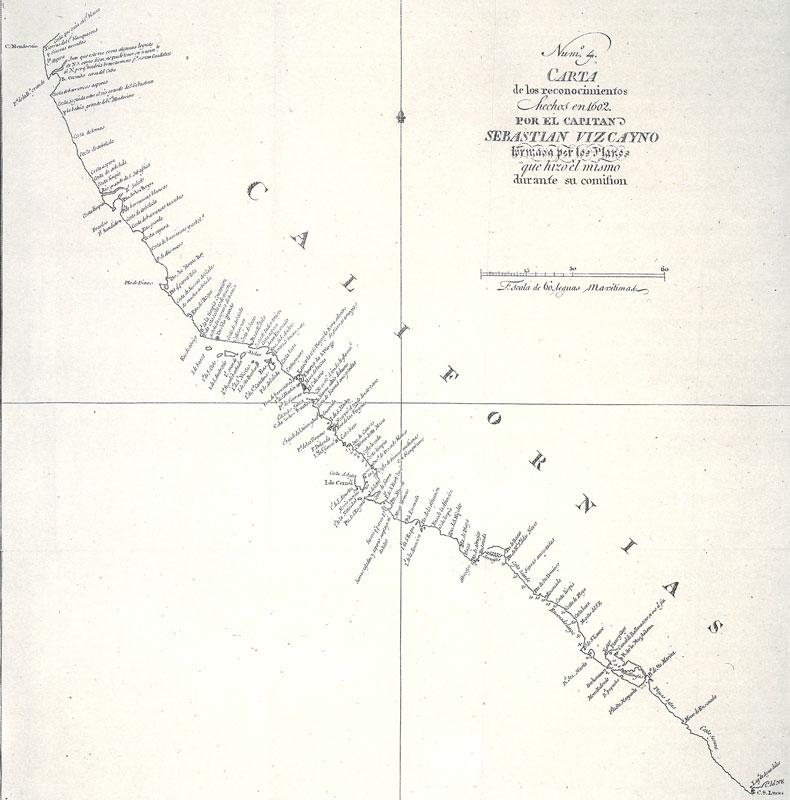
The Spaniards dedicated themselves to mapping the regions they explored.
The Spaniards sought to continue their control of the region just as they did in California.
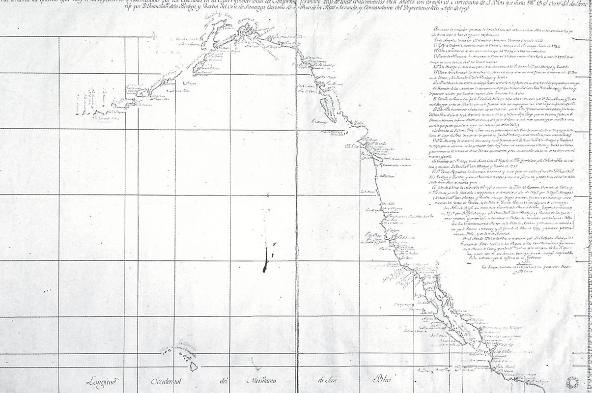
For years, the Spanish Crown hid these documents, to ensure that enemy powers did not have access to their discoveries.